rki.news
Sources: Xinhua
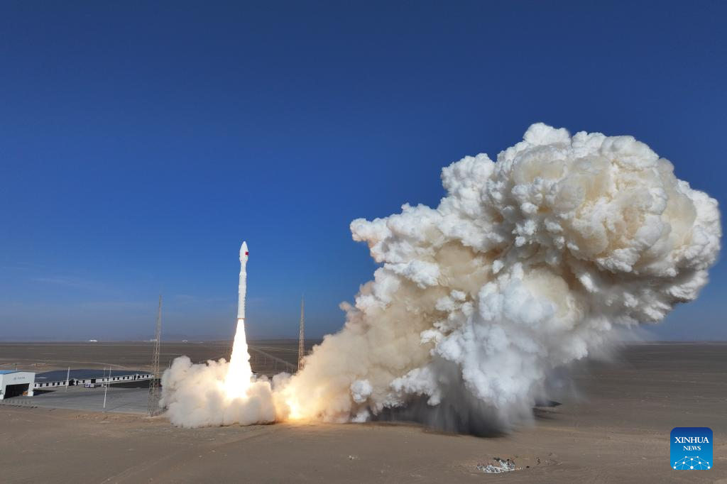
China successfully launched its Lijian 1 (Kinetica 1 Y11) carrier rocket on Wednesday, sending nine satellites including one from the United Arab Emirates (UAE) into orbit. The rocket lifted off at 12:03 p.m. Beijing Time from the Dongfeng commercial space innovation pilot zone near the Jiuquan Satellite Launch Center in northwest China.
Among the payloads was the UAE led satellite 813, designed to support environmental monitoring. It will observe soil conditions, climate patterns, and ecological changes, contributing to regional and global environmental research.
A key highlight of the mission was the deployment of Jixing High Resolution 07D01, Chinas first remote sensing satellite dedicated to the power industry. Developed with support from the State Grid Electric Power Engineering Research Institute, the satellite offers sub 0.5 meter spatial resolution, enabling precise monitoring of transmission lines, pylons, and other grid infrastructure.
Engineers report that the satellite can capture continuous east west strip imagery covering more than 200 kilometers of transmission corridors in a single pass. This advanced capability is expected to significantly enhance surveying accuracy for transmission projects and routine line inspections, improving precision by more than fivefold compared to existing systems.
The satellites applications span ultra high voltage (UHV) project management, environmental assessments of grid networks, inspection of key power corridors, disaster risk alerts, and post disaster damage evaluations.
Also aboard the rocket were two additional remote sensing satellites dedicated to water resource monitoring, urban management, and supporting digital transformation initiatives in a district of Hefei, capital of east Chinas Anhui Province.
At 'Your World in Words,' we share stories from all over the world to make friends, spread good news, and help everyone understand each other better.
© 2026
Rahbar International
Leave a Reply