
rki.news
Ms. Javeria Jabeen
Faculty of Computing, MNS University of Agriculture, Multan
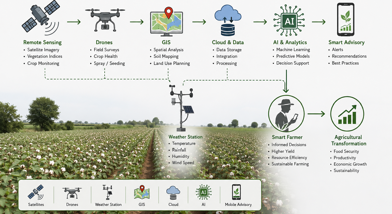
The Pakistani economy is dependent on the agricultural sector as it maintains food production in the country and sustains high rural populations. The industry is experiencing severe limitations because of Water Stress and pathogenic pressure and Land Degradation and unpredictable climatic variability. Such constraints require high level technological intervention. The AI (Artificial Intelligence) and Geographic Information Systems(GIS) and RS (Remote Sensing) provide high-quality diagnostic and predictive tools since both systems work with multidimensional field data with a high level of accuracy.
Satellite platforms, UAVs (Unmanned Aerial Vehicles) and multispectral sensor arrays can be used to offer Spatial monitoring of agricultural landscapes by remote sensing. The spectral signatures provided by each captured dataset provide information about Vegetative and reproductive progression of the plants, Soil water content and nutrient distribution. It is also possible to detect drought stress or pest infestation at an early stage since remote sensing separates anomalous reflectance patterns which would not be detected at an early stage of physiological growth by ground level observation.
Geographic information systems combine geospatial data that contains yield measures and Rainfall patterns and Soil classification into spatial analysis models. A GIS map is used to determine the best areas to cultivate by using raster based suitability analysis and highlight flood-prone areas using hydrological modelling. This system improves planning since it substitutes subjective decision making with spatial evidence created using quantitative geo-processing.
These systems are reinforced by artificial intelligence using algorithmic inference. High dimensional data learning is used to produce predictive outputs of irrigation demand and fertilizer calibration and yield projection using ML (Machine Learning) models. Image recognition modules that are based on AI identify pathogenic lesions on crop leaves with high classification accuracy due to the fact that they identify micro level texture patterns on digital images. This early warning system contributes to quick field reaction.
The combination of remote sensing and GIS and AI transforms conventional agriculture in Pakistan into a smart and sustainable precision farming system. These technologies are productive as they increase efficiency in the allocation of resources and strengthen the ability to adapt to climatic changes. The next level of development is based on the integrated interaction of academic institutions and research organizations and governmental agencies and technology enterprises. This coordination gives the farmers strong DSM (Decision Support Systems) and sensor driven tools. By these interventions Pakistan will move to a future where production will be precision based and environmental sustainability will be achieved.

At 'Your World in Words,' we share stories from all over the world to make friends, spread good news, and help everyone understand each other better.
© 2026
Rahbar International
Leave a Reply